Town of Sharon GIS puts a world of information at your fingertips
Did you know you can see your property’s value, ownership history, zoning and more on the Town of Sharon’s Geographic Information System (GIS)?
GIS connects data to a map, integrating location with all types of descriptive information from where wetlands are located to how many stories a building is.
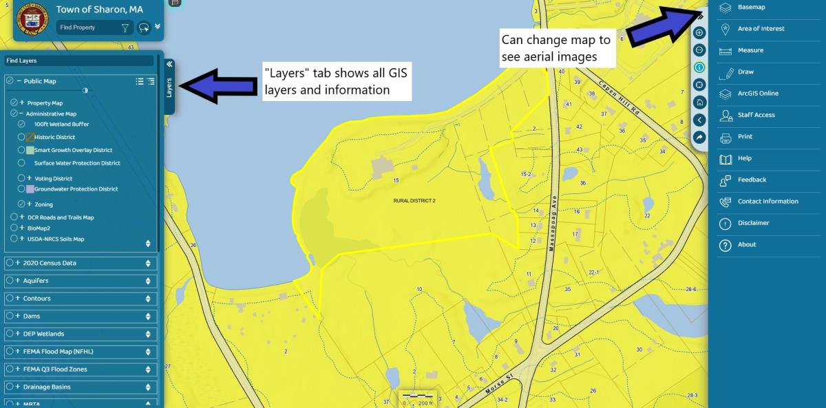
AxisGIS is the newly updated version of the Town of Sharon’s parcel and assessment maps. The dashboard now has more features and tools to use.
“There are layers that show wetlands, the wetlands/waterways buffers, easements, soils, Title 5 setbacks, just about all of our GIS information in town that both staff and residents can use,” Town GIS Coordinator Danica Cucchi said.
“There are tools that allow you to measure distances or properties and to add different imagery. If you click on a parcel, you can also find information such as owner, plot size, year built and number of bedrooms on the property card.”
The Engineering/GIS Division is working on a grant to allow parcels to be linked to the Registry of Deeds (title, deeds, etc.), as well as linking to Viewpoint/OpenGov and will show all permits that are tied to that property.
Take a look at the Town of Sharon GIS property map at https://next.axisgis.com/SharonMA/.